What is Geo Faker?
Geo Faker is a project to create fake geospatial data in PostGIS. The generated data is based on real OpenStreetMap region, using the region of your choice. The whole process is easy thanks to the PgOSM Flex project, which provides the main functionality used by Geo Faker.
The Geo Faker project currently creates two tables with fake store
and fake customer data, in tables geofaker.store and geofaker.customer
respectively. The use of OpenStreetMap data
as a starting point provides a sense of realism. The use of random()
and other methods to generate fake data avoid privacy concerns.
Warning: This project is in early development! Things will be changing quickly over the first few releases (e.g. before 0.5.0).
Faked Data
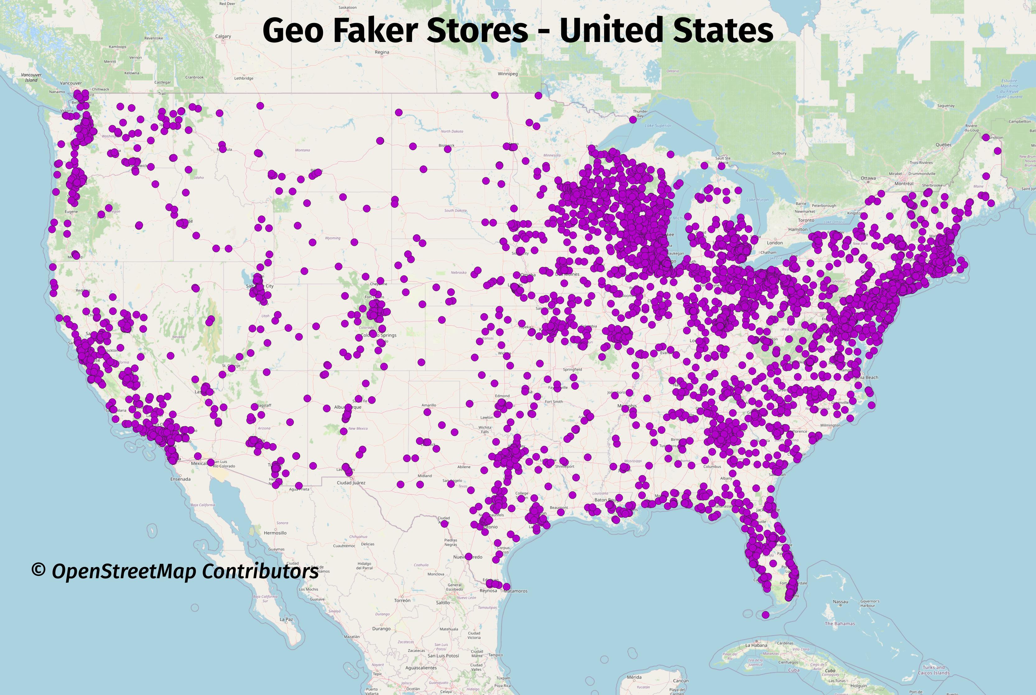
The following images show Geo Faker at work using the data from
the entire United States as its input. This first image shows
the store placements around the lower-48 states of the United States.
Store data is saved to the table geofaker.store.
Stores
SELECT *
    FROM geofaker.store
    WHERE id = 1
;
┌─[ RECORD 1 ]┬───────────────────────────────┐
│ store_id    │ 1                             │
│ city        │ Friendship Heights            │
│ street_name │ 42nd Street Northwest         │
│ ref         │ ¤                             │
│ company     │ Wolff, Bauch, and Stokes      │
│ slogan      │ Intuitive non-volatile niches │
│ phone       │ (866) 487-9434                │
└─────────────┴───────────────────────────────┘
Customers
SELECT *
    FROM geofaker.customer
    WHERE id = 1
;
┌─[ RECORD 1 ]┬──────────────────────────────┐
│ id          │ 1                            │
│ store_id    │ 1                            │
│ customer_id │ 48                           │
│ full_name   │ Gunnar Fahey Sr.             │
│ email       │ louveniahettinger@hamill.biz │
│ phone       │ (588) 985-5244               │
└─────────────┴──────────────────────────────┘
More images
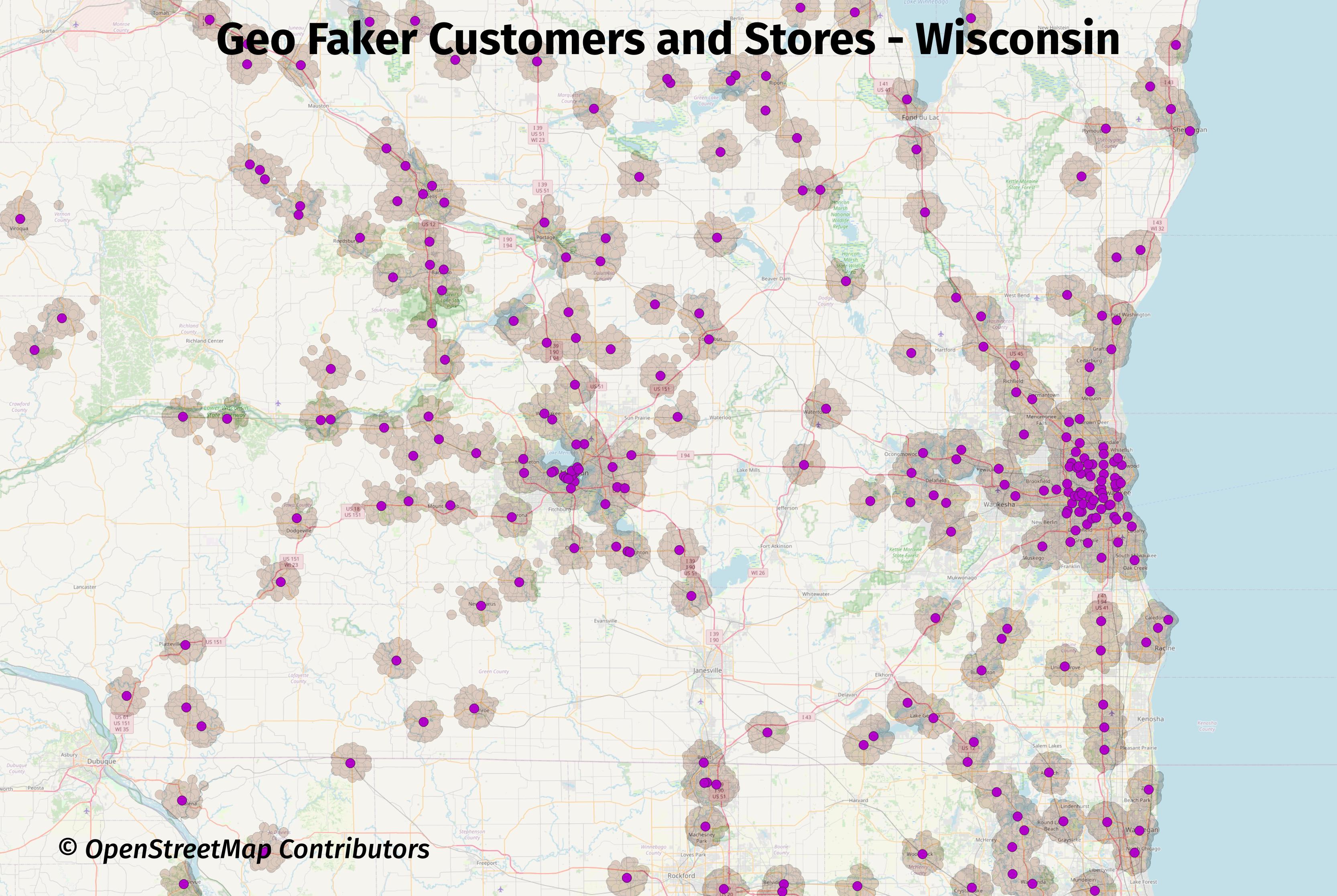
The next image is zoomed in to show the faked store and customer data in Wisconsin, with Madison, WI in the center of the image and Milwaukee, WI on the right side. This image shows the current distribution and range of the faked customer data is not ideal. It is currently hard coded to a (inexact) 5 kilometer (km) radius. Issue #6 was opened to address that limitation.
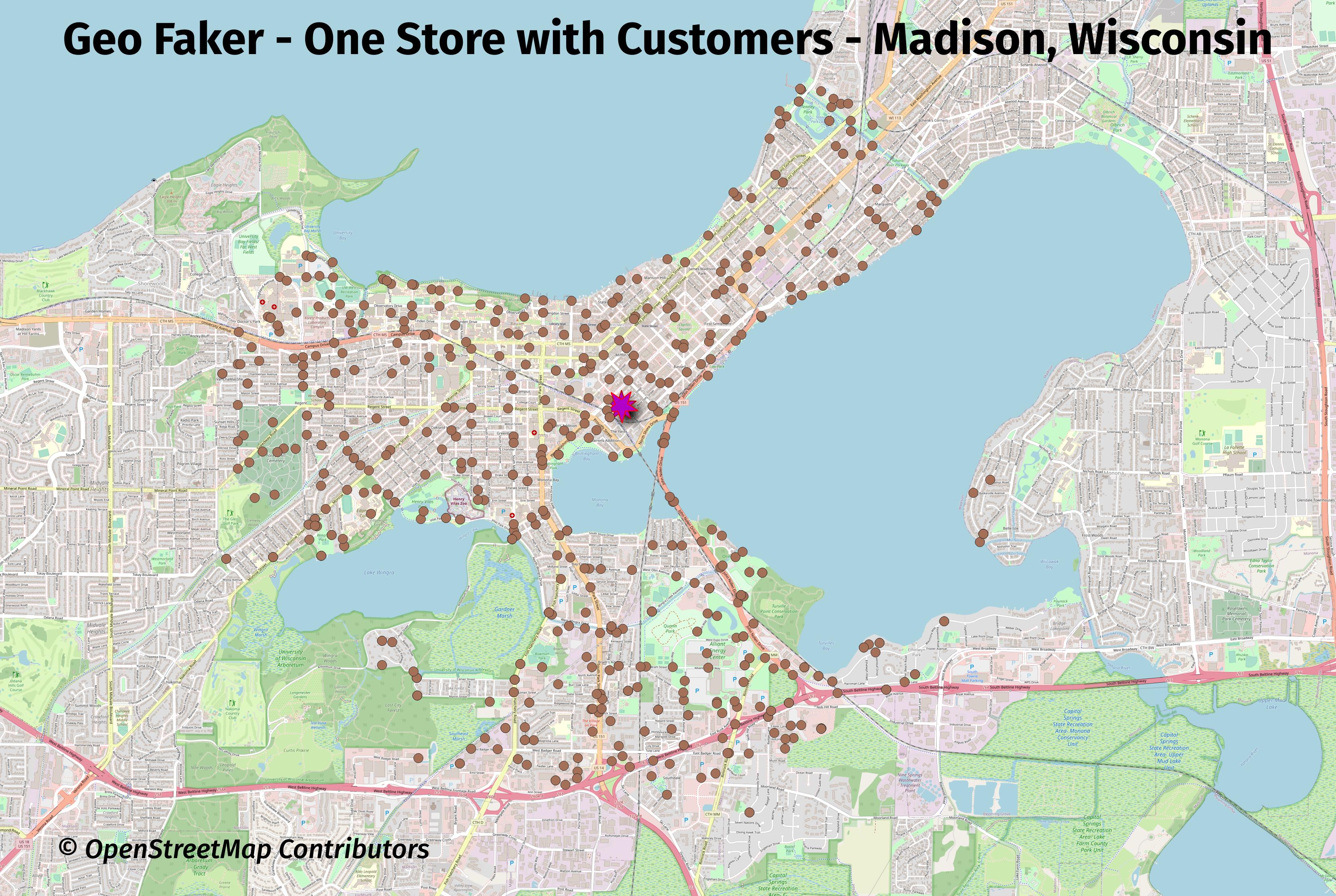
The next map is zoomed in to one store in Madison, WI with only that store's customers selected.
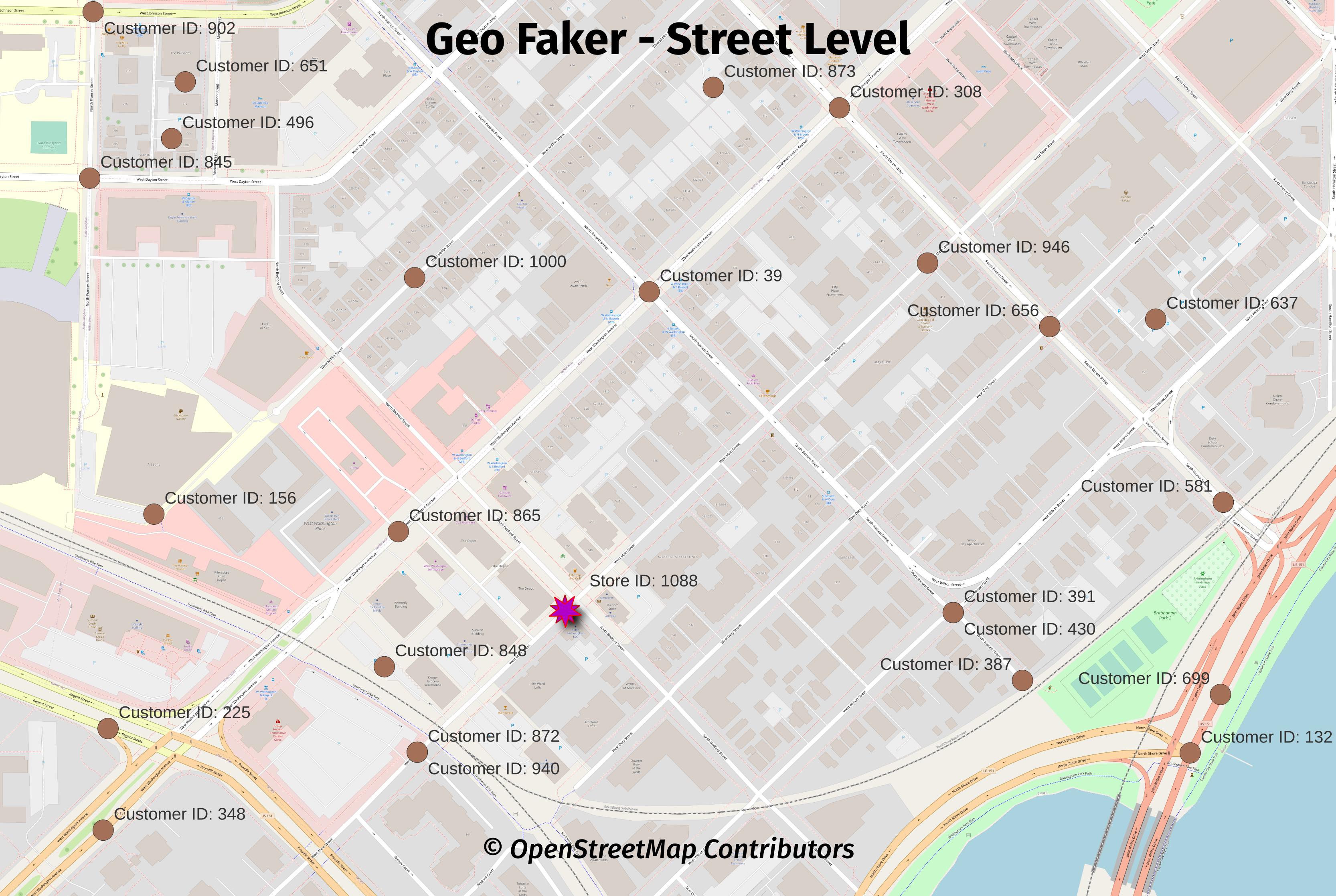
An even closer view at the street level shows that all of the points are placed directly on roads. The main reason for this was to force truly random points into a more realistic set of locations.
One benefit from this decision is this makes Geo Faker data
easy to use for routing with pgrouting.
Size of data
The exact row counts will vary from run to run, even with the same inputs. The details shown below illustrate roughly what is generated with the entire U.S. as the input.
SELECT s_name, table_count, view_count, function_count,
        size_plus_indexes
    FROM dd.schemas WHERE s_name IN ('geofaker', 'osm')
;
┌──────────┬─────────────┬────────────┬────────────────┬───────────────────┐
│  s_name  │ table_count │ view_count │ function_count │ size_plus_indexes │
╞══════════╪═════════════╪════════════╪════════════════╪═══════════════════╡
│ geofaker │           2 │          0 │              3 │ 277 MB            │
│ osm      │          10 │          1 │              4 │ 18 GB             │
└──────────┴─────────────┴────────────┴────────────────┴───────────────────┘
SELECT s_name, t_name, rows, size_plus_indexes, description
    FROM dd.tables
    WHERE s_name IN ('geofaker')
;
┌──────────┬──────────┬─────────┬───────────────────┬───────────────────────────────────────────────────┐
│  s_name  │  t_name  │  rows   │ size_plus_indexes │                    description                    │
╞══════════╪══════════╪═════════╪═══════════════════╪═══════════════════════════════════════════════════╡
│ geofaker │ store    │    4331 │ 656 kB            │ Created by Geo Faker, a PgOSM Flex based project. │
│ geofaker │ customer │ 3424117 │ 276 MB            │ Created by Geo Faker, a PgOSM Flex based project. │
└──────────┴──────────┴─────────┴───────────────────┴───────────────────────────────────────────────────┘
Checking what was loaded in the osm.pgosm_flex table.
SELECT osm_date, region, layerset, pgosm_flex_version
    FROM osm.pgosm_flex
;
┌────────────┬──────────────────┬──────────┬────────────────────┐
│  osm_date  │      region      │ layerset │ pgosm_flex_version │
╞════════════╪══════════════════╪══════════╪════════════════════╡
│ 2023-04-30 │ north-america-us │ faker    │ 0.8.0-8fb2621      │
└────────────┴──────────────────┴──────────┴────────────────────┘